Golan Heights, Israel Occupied Palestine


Coordinates: 33.2524, 35.7126
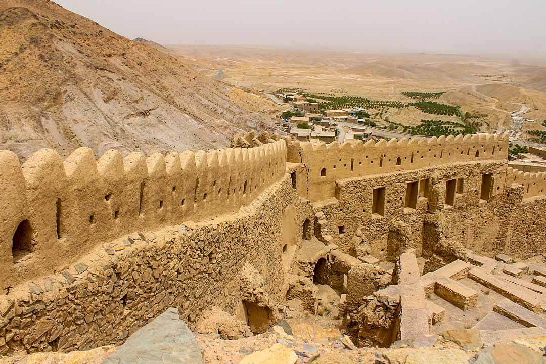
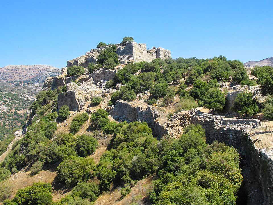
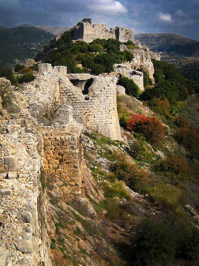
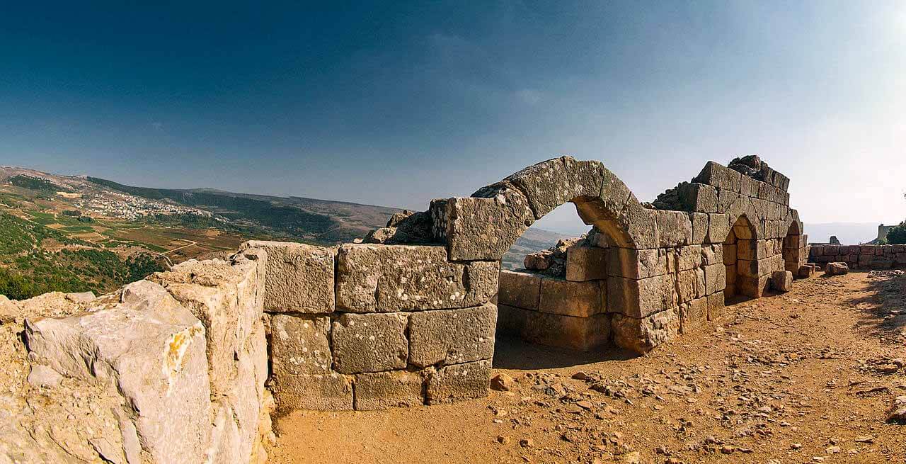
Qal’at Namrud or Nimrod Fortress is a medieval Ayyubid castle situated on the southern slopes of Mount Hermon, on a ridge rising about 800 m above sea level.
The fortress overlooks the deep, narrow valley that separates Mount Hermon from the rest of the Golan Heights, the road linking the Galilee with Damascus, and the former Crusader town of Banias.
Though once thought to be of Crusader construction, the fortress was built around 1228 by Al-Aziz Uthman, the son of Hz. Salahuddin Ayyubi’s brother al-Adil, to preempt an attack on Damascus by the armies of the Sixth Crusade.
In 1260 the Mongols captured the castle, dismantled some of its defenses and left their ally, the son of Al-Aziz ‘Uthman, in charge of it and the nearby town of Banias.
After the subsequent Mamluk victory over the Mongols at the Battle of Ain Jalut, Sultan Baibars strengthened the castle and added larger towers.
At the end of the 13th century, following the Muslim conquest of the port city of Acre (Akko) and the end of Crusader rule in the Jerusalem, the fortress lost its strategic value and fell into disrepair.
The Ottoman Turks conquered the land in 1517 and used the fortress as a luxury prison for Ottoman nobles. The fortress was abandoned later in the 16th century and local shepherds and their flocks were the sole guests within its walls.
The fortress was ruined by an earthquake in the 18th century.
Druze who came to the region during the 1860 conflict between themselves and the Maronites began calling it Qal’at Namrud (Nimrod’s Castle) anachronistically attributing it to the Biblical Nimrod.
The area is under Israeli occupation and administration since 1967 together with the adjacent Golan Heights. The international community sees the area as Syrian territory.