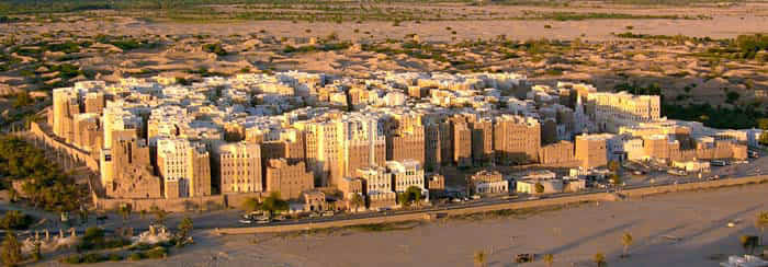
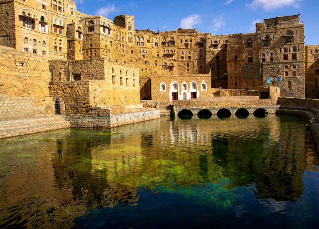
Amran, Yemen
Coordinates: 16.184992, 43.702711
Nearby Places
- Twin house 28.51 Km E (79°)
- Sa’dah old city 84.90 Km N (3°)
- Temple of Nakrah Ruins 119.46 Km E (99°)
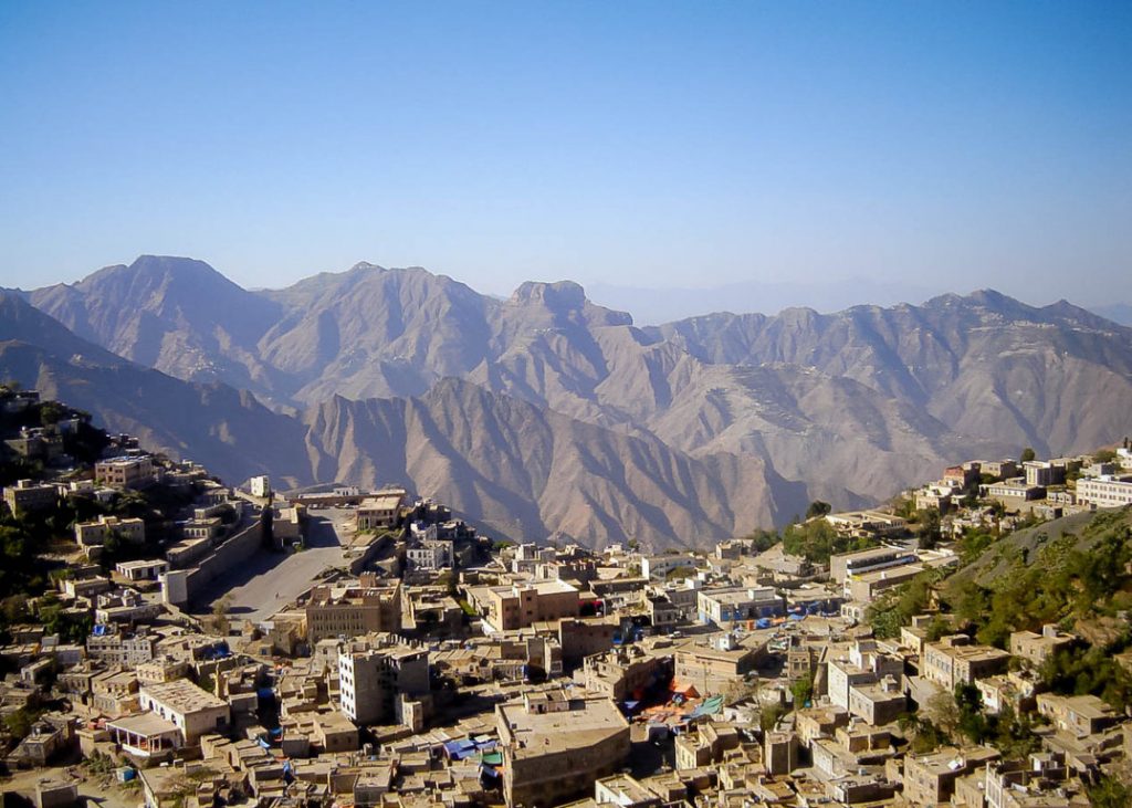
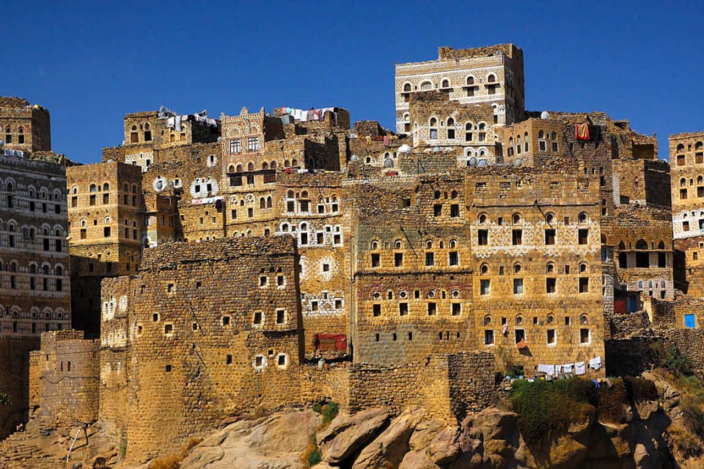
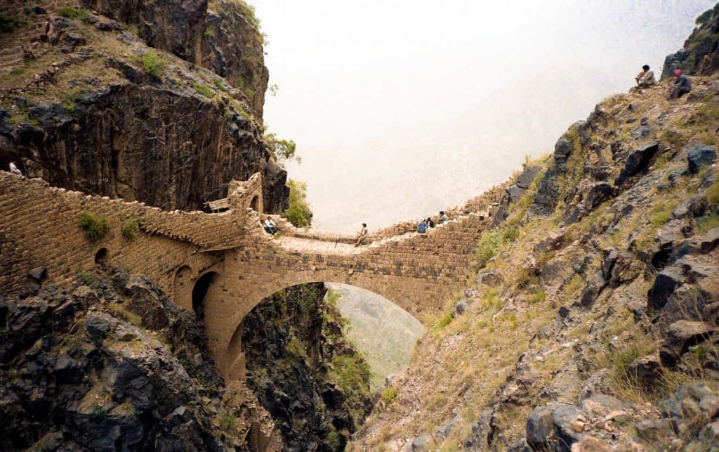
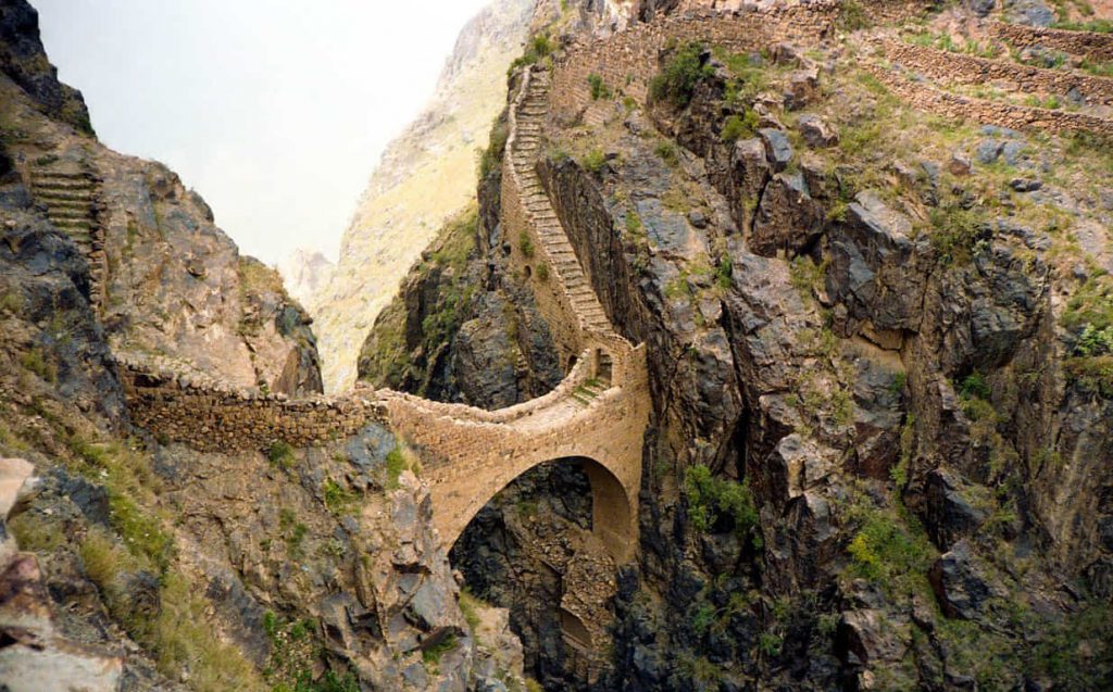
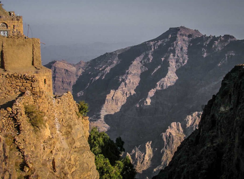
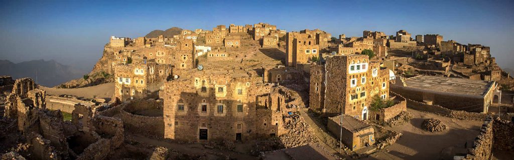
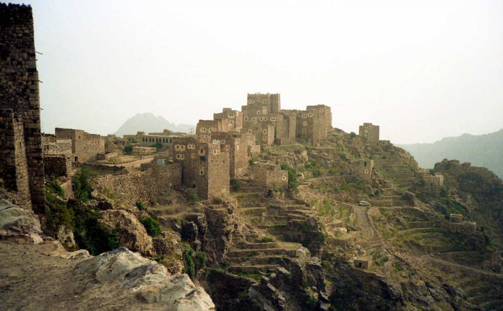
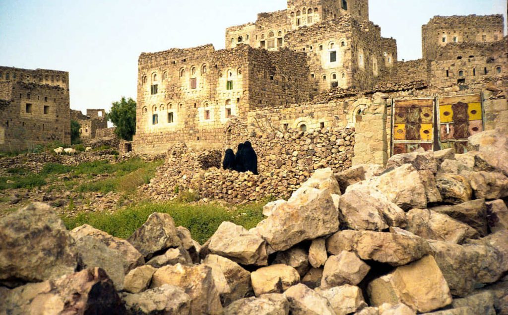
Shaharah is a large mountain village and seat of Shaharah District of the ‘Amran Governorate, Yemen.
The village “lies at 2600 meters and overlooks mountainous bulging swells to the south and shimmering hot plains to the north. The village, which lies on top of a sharp mountain of the same name, Jabal Shaharah, consists of several old stone houses and a cistern.
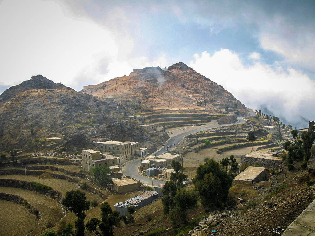
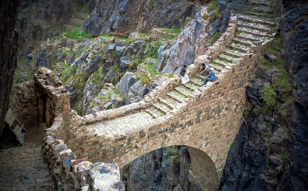
The area is noted for its limestone arch footbridge, constructed in the 17th century by a local lord to connect two villages across a deep gorge.
Know This
Unless you are a Yemeni citizen, a permit is required to travel to this remote location from Sana’a.
Sources
Image Sources
1722px-Shehara_02
By Bernard Gagnon – Own work, CC BY-SA 3.0, https://commons.wikimedia.org/w/index.php?curid=4461318
1743px-Shaharah_Bridge
By Bernard Gagnon – Own work, CC BY-SA 3.0, https://commons.wikimedia.org/w/index.php?curid=18267798
1736px-Shaharah_bridge
By Bernard Gagnon – Own work, CC BY-SA 3.0, https://commons.wikimedia.org/w/index.php?curid=6231801
1743px-Shaharah_01
By Bernard Gagnon – Own work, CC BY-SA 3.0, https://commons.wikimedia.org/w/index.php?curid=6231779
1748px-Shehara_01
By Bernard Gagnon – Own work, CC BY-SA 3.0, https://commons.wikimedia.org/w/index.php?curid=4461305