Socotra Island, Yemen

Coordinates: 12.574187, 54.020843
Nearby Places
- Skand Peak 0.84 Km E (104°)
- Hadiboh, coastal town in Socotra 8.40 Km N (356°)
- Socotra Airport 13.78 Km NW (296°)
- Delisha Beach 17.27 Km NE (42°)
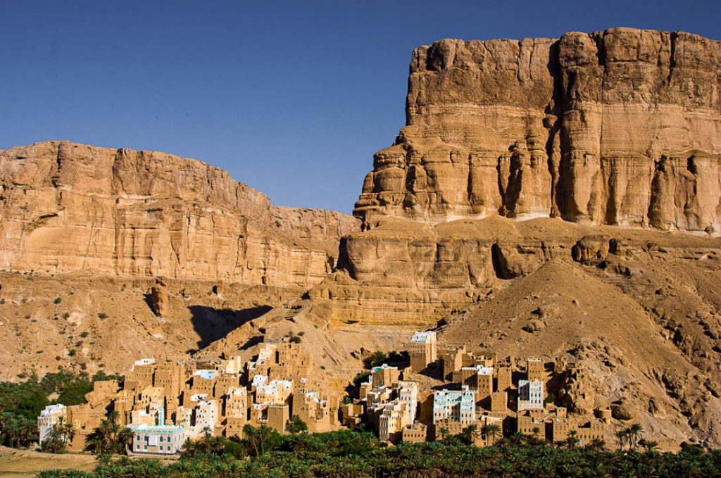
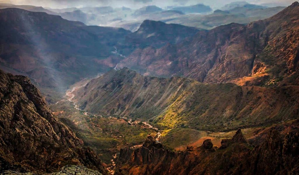
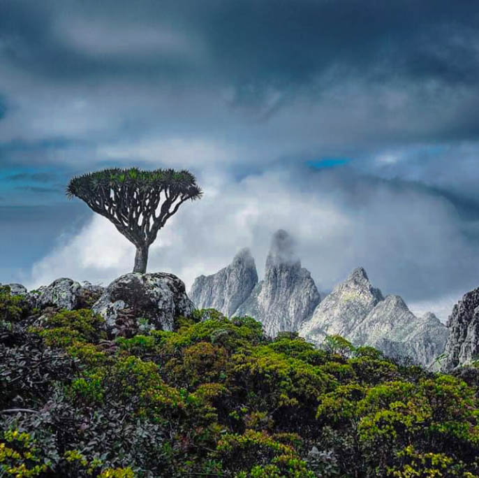
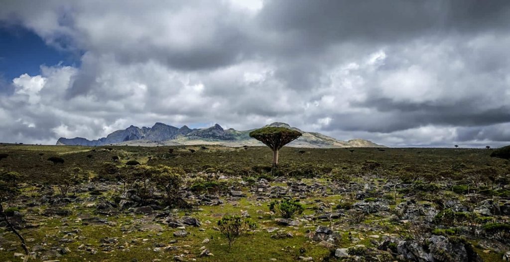
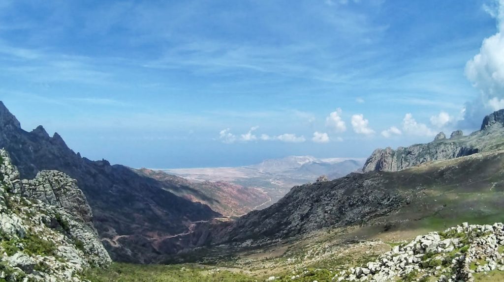
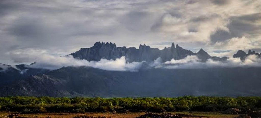
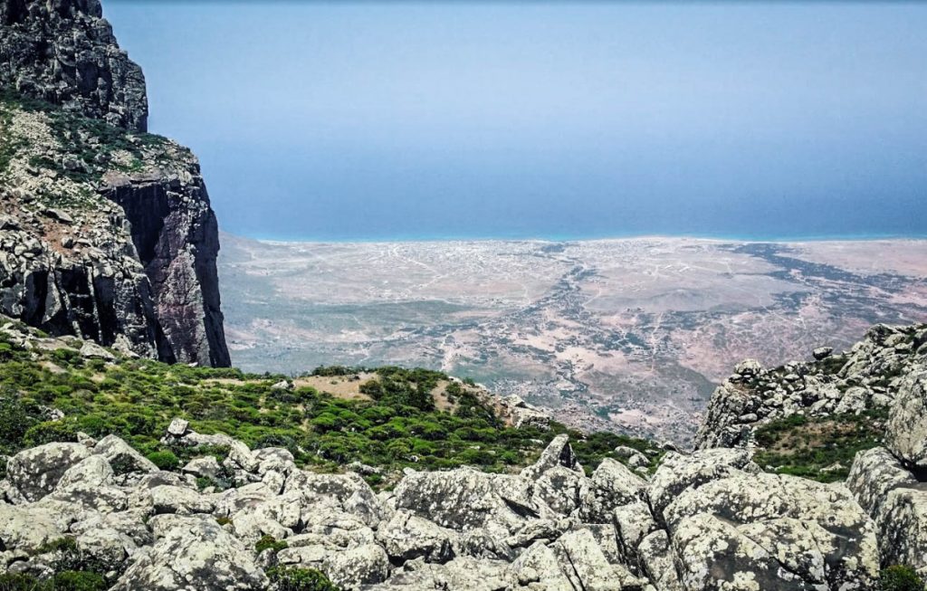
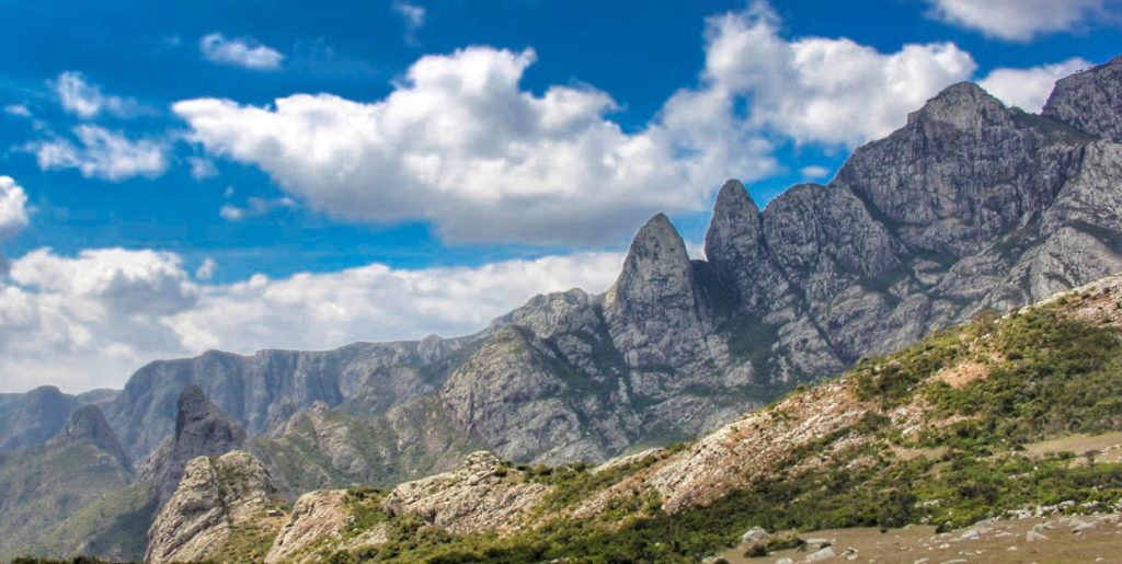
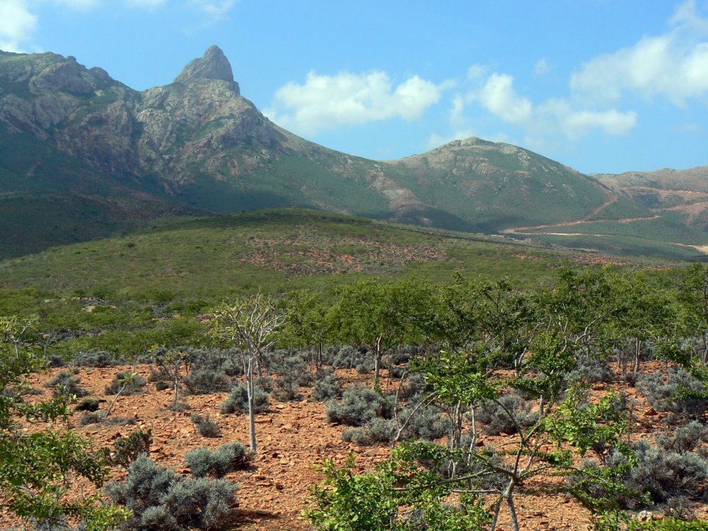
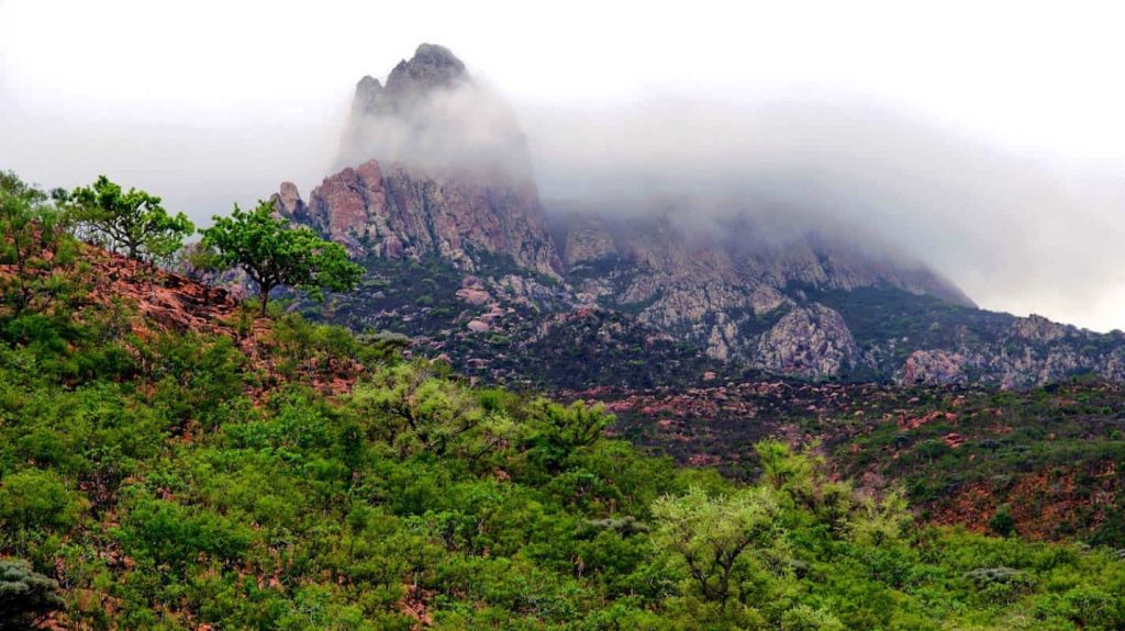
The Hajhir Mountains are a spectacular range of sharp peaks rising in the center of Socotra Island. The most scenic valleys, canyons, and mountains, richly covered with amazing endemic greenery (first of all, quirky Dragon Blood trees in abundance) and offering truly breathtaking views, especially from the top of the peak.
Spending a few days and wending through these mountains is a beautiful experience to see the dramatic peaks, the dragon blood, bottle, and cucumber trees, and to meet with locals living there.
The mountains are home to more than 100 of Socotra’s indigenous species. More than 50 species are confined to this mountainous region alone.
Socotra’s primary watershed, the Hajhir Mountains, are remnants of ancient volcanic activity, but Socotra is not a volcanic island like the Hawaiian chain.
Know This
There is a fee for going to the area with a guide. To view the peaks from the coast would be free but you would miss so much.
Sources
Image Sources
Arher_dunes_and_Hoq_cave_(6408216391)
By Gerry & Bonni – Arher dunes and Hoq cave, CC BY 2.0, https://commons.wikimedia.org/w/index.php?curid=38582219
1618px-Wadi,Socotra_Island(10941888296)
By Rod Waddington from Kergunyah, Australia – Wadi, Socotra Island, CC BY-SA 2.0, https://commons.wikimedia.org/w/index.php?curid=29765658